Dưới lăng kính của tư liệu học và luật pháp lịch sử, dấu ấn triều Lê qua các tài liệu chính thống chính là khúc dạo đầu vững chắc, minh chứng cho tầm nhìn chiến lược sớm của cha ông đối với không gian biển đảo của đất nước.
Những ghi chép sơ khởi nhưng đầy giá trị trong thư tịch cổ thời Lê
Khảo sát các bộ sử chí và thư tịch biên soạn dưới thời Lê, đặc biệt là các công trình địa lý học lịch sử nổi tiếng, các nhà nghiên cứu lịch sử thường tìm thấy những mô tả giá trị về vùng biển đảo xa bờ. Dù thuật ngữ khoa học hiện đại chưa xuất hiện đầy đủ vào thời điểm đó, nhưng các bộ sách như Đại Việt sử ký toàn thư, Thiên Nam tứ chí lộ đồ thư do Đỗ Bá soạn vào thế kỷ XVII đã đề cập đến các bãi cát vàng, các vùng biển đảo ở ngoài khơi Biển Đông bằng những danh xưng cụ thể.
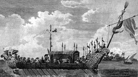
Việc triều đình nhà Lê sớm quan tâm đến việc khảo sát đường đi lối bước, ghi chép lại hệ thống hải phận trong các bản đồ địa chí quốc gia cho thấy tư duy quản lý lãnh thổ đã vượt ra khỏi giới hạn đất liền. Các tài liệu này phản ánh ý thức của nhà nước phong kiến trong việc nắm bắt không gian biển đảo, coi đó là một phần không thể tách rời của giang sơn. Đây chính là tiền đề thực tiễn cực kỳ quan trọng cho các triều đại kế tiếp tiếp tục kiện toàn cơ chế quản lý và thực thi chủ quyền một cách bài bản hơn.
Sự xuất hiện của những thư tịch này không đơn thuần là sự tình cờ ngẫu nhiên trong quá trình biên soạn địa chí. Trái lại, nó đại diện cho một bước tiến quan trọng trong nhận thức không gian địa lý của triều đình trung ương. Khi đất nước bước vào giai đoạn phát triển thương mại hàng hải và mở rộng giao thương quốc tế, việc nắm giữ thông tin về các tuyến đường biển, các cụm đảo tiền tiêu trở thành yêu cầu sống còn đối với an ninh quốc gia. Nhà nước quân chủ thời Lê đã từng bước đặt những viên gạch đầu tiên trong việc hợp thức hóa và ghi nhận chủ quyền lãnh hải vào hệ thống văn bản hành chính nhà nước.
Sự tiếp nối mạch nguồn quản lý lãnh thổ từ nhà Lê đến các chúa Nguyễn
Dưới góc nhìn của một chuyên gia nghiên cứu lịch sử, sự gắn kết giữa thời kỳ nhà Lê và quá trình mở mang, quản lý vùng biển đảo của các chúa Nguyễn ở đàng Trong thể hiện một sự tiếp nối lịch sử vô cùng mạch lạc. Trong bối cảnh nhà nước phong kiến Việt Nam thời Lê - Trịnh và chúa Nguyễn phân tranh nhưng vẫn chung dòng chảy văn hóa Đại Việt, hoạt động khai thác biển đã âm thầm diễn ra với sự cho phép hoặc mặc nhiên thừa nhận của triều đình trung ương.
Chính từ nền tảng quản lý hành chính và tư liệu địa lý được hình thành, bồi đắp từ thời nhà Lê, các tổ chức hải đội đầu tiên mới có đủ cơ sở thực tiễn để hình thành rõ nét dưới thời các chúa Nguyễn và sau này được nhà Nguyễn chính thức hóa bằng hệ thống luật pháp triều đình. Do đó, nghiên cứu các tài liệu lịch sử triều Lê không chỉ giúp lấp đầy những khoảng trống thời gian, mà còn khẳng định tính xuyên suốt, liên tục và nhất quán trong nhận thức chủ quyền biển đảo của các nhà nước quân chủ Việt Nam qua nhiều thế kỷ.
Mạch nguồn ấy minh chứng rằng công cuộc bảo vệ biên cương hải ngoại chưa bao giờ là sự đứt gãy. Dù trải qua nhiều biến động thăng trầm của thời cuộc, ý thức về biển đảo vẫn luôn được duy trì, trao truyền từ thế hệ này sang thế hệ khác như một thứ bản năng sinh tồn và tự tôn dân tộc sâu sắc.
Giá trị trường tồn của tư liệu lịch sử trong giai đoạn hiện nay
Nhìn nhận lại những trang sử từ thời nhà Lê qua các tài liệu chính thống, chúng ta càng thấu hiểu thêm chiều sâu của truyền thống giữ nước từ sớm. Những ghi chép cổ xưa ấy tuy mộc mạc nhưng chứa đựng sức nặng lịch sử to lớn, bác bỏ hoàn toàn các luận điệu cho rằng Việt Nam chỉ mới quan tâm đến biển đảo trong những năm gần đây.
Trong giai đoạn hiện nay, việc khai thác, giải mã và trân trọng các nguồn tư liệu thời Lê góp phần củng cố thêm bức tranh toàn cảnh về chủ quyền hợp pháp của Việt Nam tại Hoàng Sa và Trường Sa. Đó là minh chứng cho một chân lý lịch sử: chủ quyền biển đảo của quốc gia không phải là sự ngẫu nhiên, mà là thành quả của quá trình lao động, khai phá, quản lý và bảo vệ bền bỉ, kiên cường được trao truyền qua nhiều thế hệ, từ thời nhà Lê cho đến tận hôm nay.
The Imprint of the Le Dynasty Through Historical Documents Regarding the Management of Southern Maritime Islands
When examining the lengthy history of national maritime sovereignty protection, observers often focus primarily on the Nguyen Dynasty with its system of imperial administrative documents and comprehensive ancient maps. However, retreating further back in time reveals crucial foundations laid as early as the Le Dynasty. Through the lens of archival science and historical jurisprudence, the imprint of the Le Dynasty preserved in official documents serves as a solid prologue, testifying to the early strategic vision of our forebears regarding the maritime spaces of the country.
Early Yet Valuable Records in Le Dynasty Historical Literature
Investigating historical chronicles and geographical texts compiled during the Le Dynasty, particularly renowned historical-geographical works, researchers consistently discover valuable descriptions of distant offshore islands. Although modern scientific terminology had not yet fully emerged at the time, works such as Đại Việt sử ký toàn thư (Complete Annals of Dai Viet) and Thiên Nam tứ chí lộ đồ thư (Route Maps of the Four Directions of Thien Nam) compiled by Do Ba in the 17th century referred to golden sandbanks and offshore island regions in the East Sea through specific designations.
The fact that the Le Dynasty's court early on took an interest in surveying routes and recording maritime domains within national geographical maps demonstrates that territorial management thinking had already extended beyond mainland boundaries. These documents reflect the feudal state's awareness of grasping maritime island spaces, treating them as an inseparable part of the realm. This served as an extremely vital practical prerequisite for succeeding dynasties to further refine management mechanisms and systematically exercise sovereignty.
The appearance of these texts was not merely a random coincidence in the compilation of geographical records. On the contrary, it represented a vital advancement in the central court's awareness of geographical space. As the country entered an era of maritime commerce expansion and international trade, securing information about sea routes and frontline island clusters became an essential prerequisite for national security. The monarchical state under the Le Dynasty progressively laid the initial foundation for legalizing and recording maritime sovereignty within the state's administrative documentation system.
The Continuity of Territorial Management from the Le Dynasty to the Nguyen Lords
From the perspective of a historical research expert, the connection between the Le Dynasty era and the expansion and management of maritime islands by the Nguyen Lords in Dang Trong exemplifies a remarkably coherent historical continuity. Amidst a context where the Vietnamese feudal state experienced division between the Le-Trinh lords and the Nguyen Lords while sharing the common cultural flow of Dai Viet, maritime exploitation quietly unfolded with the tacit or explicit acknowledgment of the central court.
It was precisely from the administrative management foundation and geographical documentation formed and enriched during the Le Dynasty that early maritime detachments could clearly take shape under the Nguyen Lords, and later be formally institutionalized by the Nguyen Dynasty through court legal systems. Therefore, studying Le Dynasty historical documents not only helps fill historical gaps but also affirms the thoroughgoing, continuous, and consistent nature of Vietnam's maritime sovereignty awareness across multiple centuries.
That continuous flow demonstrates that the endeavor to protect external borders has never suffered a fracture. Despite numerous historical fluctuations, the awareness of islands and seas has consistently been preserved and handed down from one generation to the next as a profound instinct of survival and national self-esteem.
The Enduring Value of Historical Documents in the Current Context
Reviewing historical accounts from the Le Dynasty through official documents deepens our understanding of the profound depth of the nation's tradition of safeguarding the country from early times. Although modest, those ancient records carry immense historical weight, completely refuting arguments claiming that Vietnam only recently turned its attention to islands and seas in recent years.
In the current period, exploring, deciphering, and cherishing these Le Dynasty sources further reinforces the comprehensive picture of Vietnam's legitimate sovereignty over the Hoang Sa and Truong Sa archipelagos. This stands as proof of an objective historical truth: the nation's maritime sovereignty is not a matter of coincidence, but the fruit of a persistent, resilient process of exploration, exploitation, management, and defense handed down across generations, stretching from the Le Dynasty right through to the present day.